|
ЛОТ 77:
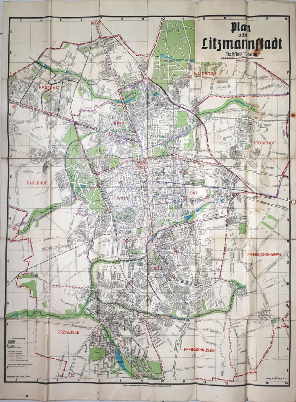
Map of Litzmanstadt with the borders of the Jewish ghetto - Lodz, 1942
далее...
|
|


|
Стартовая цена:
$
500
Комиссия аукционного дома: 22%
НДС: 18%
Только на комиссию
|
Map of Litzmanstadt with the borders of the Jewish ghetto - Lodz, 1942
Plan von Litzmannstadt mit Strassenverzeichnis - [Map of Litzmannstadt with street index], by Erwin Thiem. Published by S. Spiegelt, Lodz, 1942. German. Scale: 1:20000.
A large map of the city of Lodz that includes the Jewish ghetto area, which was published in the midst of wwII, about two years after the ghetto was established. On the back of the map is a detailed list of the street names of the city of Lodz in the letters order. The streets of the Jewish ghetto appear on the back of the map in a series of letters and numbers at the top under the heading "Strasse Getto Norden". On the map itself, the borders of the ghetto were manually marked in purple.
In November 1939, the city of Lodz was annexed to Nazi Germany. The city was given a new name, Litzmannstadt, in honor of the German general Karl Litzmann who captured the city during the First World War. Shortly after the occupation of the city, the Nazi authorities established the Lodz Ghetto inside the city which housed more than 200,000 Jews from Lodz and the surrounding area. As you can see on the map, the ghetto was established in the northern part of the city center, in the Baluty neighborhood. To the south of the ghetto is Polnocna Street. On February 8, 1940, the ghetto was officially declared and Jews were deported into it, although the ghetto was still open. The ghetto was sealed and completely locked on May 1, 1940. Any Jew caught outside the ghetto was by law, allowed to be shot at short range. The process of extermination worked strictly, when the Jews of Lodz were sent to be exterminated, other Jews were brought in their place to the ghetto. The Lodz ghetto was the last large ghetto to be exterminated.
95x68 cm. Fold marks. few stains. Good condition.
